


URBANDALE PCT 12, Dallas County, Iowa
About
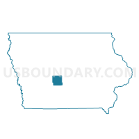
Outline

Summary
| Unique Area Identifier | 581913 |
| Name | URBANDALE PCT 12 |
| County | Dallas County |
| State | Iowa |
| Area (square miles) | 6.86 |
| Land Area (square miles) | 6.86 |
| Water Area (square miles) | 0.00 |
| % of Land Area | 100.00 |
| % of Water Area | 0.00 |
| Latitude of the Internal Point | 41.64713530 |
| Longtitude of the Internal Point | -93.83832810 |
Maps


Graphs
Select a template below for downloading or customizing gragh for URBANDALE PCT 12, Dallas County, Iowa


Neighbors
Neighoring Voting District (by Name) Neighboring Voting District on the Map
- CLIVE IN DALLAS COUNTY PART Voting District, Dallas County, IA
- CLIVE IN POLK COUNTY Voting District, Polk County, IA
- GRIMES W/JEFFERSON TWP & WEBSTER TWP & URBANDALE PARTS Voting District, Polk County, IA
- URBANDALE PCT 11, Polk County, IA
- WALNUT TWP W/O CLIVE & GRIMES PART & URBANDALE & WAUKEE Voting District, Dallas County, IA
- WAUKEE W/BOONE TWP & CLIVE PARTS Voting District, Dallas County, IA
Top 10 Neighboring County Subdivision (by Population) Neighboring County Subdivision on the Map
- Walnut township, Polk County, IA (66,174)
- Webster township, Polk County, IA (54,365)
- Walnut township, Dallas County, IA (22,310)
Top 10 Neighboring Place (by Population) Neighboring Place on the Map
- Urbandale city, IA (39,463)
- Clive city, IA (15,447)
- Waukee city, IA (13,790)
- Grimes city, IA (8,246)
Top 10 Neighboring Unified School District (by Population) Neighboring Unified School District on the Map
- West Des Moines Community School District, IA (64,104)
- Waukee Community School District, IA (37,076)
- Urbandale Community School District, IA (20,971)
- Dallas Center-Grimes Community School District, IA (9,527)
Top 10 Neighboring State Legislative District Lower Chamber (by Population) Neighboring State Legislative District Lower Chamber on the Map
- State House District 47, IA (54,425)
- State House District 69, IA (51,009)
- State House District 63, IA (34,062)
- State House District 59, IA (29,055)
Top 10 Neighboring State Legislative District Upper Chamber (by Population) Neighboring State Legislative District Upper Chamber on the Map
- State Senate District 35, IA (92,402)
- State Senate District 24, IA (83,683)
- State Senate District 32, IA (62,004)
- State Senate District 30, IA (60,636)
Top 10 Neighboring 111th Congressional District (by Population) Neighboring 111th Congressional District on the Map
Top 10 Neighboring Census Tract (by Population) Neighboring Census Tract on the Map
- Census Tract 113, Polk County, IA (13,584)
- Census Tract 508.05, Dallas County, IA (5,802)
- Census Tract 508.03, Dallas County, IA (5,745)
- Census Tract 501, Dallas County, IA (4,499)
- Census Tract 509.02, Dallas County, IA (3,933)
- Census Tract 112.03, Polk County, IA (3,596)